Sunday, August 28, 2022

North Palisade


North Palisade – at 14,242 ft – is the third highest mountain in the Sierra Nevada Mountains of California. Unlike the two that are higher in that state, there is no hiking trail to the top. My goal was to try West Chute + Clyde variation – a Sierra “Class 4” route. The overall climb is nicely divided into 4 distinct sections – starting with hiking on a well-developed trail, then by talus hopping, followed by going up (and sometimes sliding down) a steep, loose gully, and, finally, by some fun scrambling up reasonably decent rock. Total round trip is about 20 miles. Many years ago, I had tried twice to get to the summit of North Pal by other routes without success. Although I hadn’t been to the Sierra in a few years, all the hiking and scrambling in the Pyrenees this summer had been good training and I felt in good shape to attempt North Pal.

On the drive in through Westgard Pass, one gets amazing views of the Sierra crest just south of North Pal. Whatever mental intimidation factor I had was overwhelmed by the views of Middle Pal and Norman Clyde peaks during the drive. When I got to Bishop, I went for a short walk to stretch my legs while admiring the views of Mount Sill (just south of North Pal and on the same ridgeline). North Pal, however, was hidden from my view by another mountain.

Next day, Friday, the alarm went off at 3 AM. I had some coffee, drove to the trailhead (South Lake Trailhead at 10,000 ft), and started off with headlamp at 4:30. The first 6 miles to Bishop Pass (12,000 ft) are on a good trail. There are many lakes and streams along this section. When I was about 2/3rd of the way to the pass, the sun started coming up and I enjoyed the morning glow on the mountains. The trail section went smoothly and I got to the pass a bit before 7. At the pass, I left the trail (which goes down another 6 miles in another direction to meet the famous John Muir trail) and started going cross-country on some nice benches towards Thunderbolt Pass (also ~12,000 ft)

The region between Bishop Pass and Thunderbolt pass is called Dusy Basin. There are several nice lakes in this basin. On the left edge of this basin are two 13ers – Agassiz and Winchell. On the south edge of this basin is Thunderbolt Pass. One can also see Columbine Peak, with its unrepeated Death Dihedral route, just to the south of this basin.

The section between Bishop and T-bolt passes ends with a mandatory and annoying talus (mid to large sized) hopping section. Going a bit below the two passes on the bench section allows one to traverse the first part fairly easily. This, obviously, requires gaining back some altitude to get to T-bolt pass. However, this tradeoff was worth it. This whole section of about 2 miles took me about 1.5 hours, and I got to T-bolt pass at about 8:30 AM.

Whatever annoyance the final section to T-bolt pass brought melted away instantly when I got to the pass. South of pass is Palisade Basin. This is my most favorite area of the Sierra – which itself is my happy place. There are alpine lakes to my right, big steep mountains to my left (including North Pal), and an expansive panorama of other Sierra peaks to the south and the east.

However, Palisade Basin is more than just views for me. Many years ago, when I first went to this area to climb Mount Sill, I camped in this basin. In the evening, the alpenglow on the west face of North Pal along with the light shimmering on the surface of the lake near which I was camped was mesmerizing and very calming. I remember just lying on the sleeping pad outside the tent and gazing at the lighted west face of North Pal till the evening light faded.

Just south of T-Bolt pass is perhaps the most prominent part of this crest. The 5 peaks just south of the pass are all over 14,000 ft in the following order bearing south: Thunderbolt Peak, Starlight Peak, North Palisade, Polemonium Peak, and Mount Sill. None of them have an easy path up (the easiest would perhaps be Mount Sill where one can keep the difficulty down to class 3 with careful route finding).

After taking in the experience from the pass for a few minutes, I started towards the largest scree/talus fan closer to the other end of the basin. This is where the west chute of North Pal begins. The level was similar to that in Dusy Basin – a bit annoying, but just straightforward talus hopping. In about 45 minutes, I was at the talus fan at the base of the west chute.

Going up the first hundred vertical feet or so in the talus/scree chute is more annoying than steep – it is just a bit loose. After that, although the steepness increases, there are well-worn climbers’ paths (multiple) and the going, though tedious and tiring, is not particularly sketchy. I stayed closer to one or the other side of the chute to be closer to a more solid terrain. It was mostly class 2, with some class 3 thrown about 2/3rd way up the chute leading to the narrower part of the upper chute. This narrower part of the upper chute is where tings get a bit more sketchy: steeper and looser. Two steps forward and one step sliding backward. It was very tedious and, for the first time, I started to feel tired – mentally and physically in equal measures.

This upper chute deposited me on the so-called U-Notch (between North Pal and Polemonium). At the notch, one can see the other side (east) of the Palisade crest. Looking down the other side of the notch, one can see Palisade Glacier and a very “glacial silted” green lake. I admired the view for a couple of minutes, and then got back to trying to see a way up the headwall to my north.

I had a decent Summitpost description of the route (Clyde Variation) from the notch. Most of it made sense as I looked up the headwall – expect I couldn’t see where the left turn from up the class 3 ledge was. I guess I will have to find out. The broken chimney up to “a” ledge seemed class 3ish. Fairly confident that I could downclimb that if that led to a dead-end, I went up it. The leftward ramp was obvious from the top of the ledge, but getting to the ramp required one tricky (but still class 3ish) move and one a bit harder move (class 4 or very easy class 5). Although there was some mild exposure, I felt confident and secure.

The next 30-40 feet on the ramp were fairly easy and I passed one rap sling. Around the corner from the ramp, I got into another mini-gully. This one was very solid class 3 gully with decent rock for almost 2 full pitches. Heaven! I made a small cairn to guide me around the ramp when on the way down and also made a mental note of the surroundings. This fun and secure scramble deposited me on the very ridge. An airy traverse on to the other side opened up to more spectacular views – I could see the summit of North Pal for the first time (and it was tantalizingly close). To the south, I could see Sill not that far off (maybe 0.25 mile). And, probably the most eyepopping was the first part of the ridge between Polemonium and Sill – the very definition of a spectacular class 4 knife-edge! I had seen pictures of this knife edge – but seeing it so close (a few hundred yards from me) in real life was amazing, even if I was not going to be on it this time.

Back to the fun part I was going to do this time. Traverse the ridge to north – keeping on the east side shortly before crossing back over to the west side. This traverse was fairly straightforward, but required some concentration. When I got back to the west side, I, for the first time, saw North Pal’s summit bowl – with the summit just about 100 ft above that. The description I had said something along these lines – “You have made it to here, you can figure out the rest”. It required some zig-zagging up through some easy class 3 blocks to get just below the summit block.

There are apparently 3 types of ways (from other descriptions that I had read) to the final summit block from just below it. One requires going up a narrow squeeze chimney, one requires jumping from one block to the summit block, and the last one requires some very slightly exposed boulder problem. My claustrophobia made the first option moot. The second did not appeal to me at all. So, that left the third option. The exposure was almost non-existent, so I decided to try it. Right foot high step smear the summit block (hiking shoes), layback the edge of the block just below the summit block, grab the top of the summit block, slight pull-up, left foot on a decent foot hold, let go of the right foot smear, mantle on to the summit block. Voila! I was on top of North Palisade!

The views from the summit are just amazing – Palisade Basin to the west, Palisade Glacier to the east, and Sierra Crest running north to south. As North Pal is part of a very jagged crest/ridge, sitting atop North Pal, one can’t see the bottom of the notches between it and Polemonium to the south (this is the U-Notch) and between it and Starlight to the north. So, basically, you see two immediate, lower summits sort of floating in the air. To make matters more interesting, there was a party climbing up the summit block of Starlight at the same time.

I spent about 30 minutes on the summit. Now, it was almost 1:30 PM. Time to head down. Repeating the boulder antics down from the summit block felt reasonable. As did the zig-zag down and the ridge traverse to the solid class 3 gully down from the ridge. I kept an eye out for the cairn I had made to notify me of when to look for the ramp around the corner. Yep – there it was. The ramp down was okay too. Downclimbing the crux (from the ramp to the ledge) required some concentration, but I was soon down to the chute.

The top part of the chute had felt sketchy on the way up, now that sketchiness was magnified on the way down. Even the more benign middle part which had felt okay on the way up was cumbersome of the way down. It probably took me over two hours to get down the chute. And, I was getting pretty tired by now. I still had plenty of daylight (and, a headlamp), so I wasn’t worried per se – just had to mentally prepare myself for all the tiresome talus hopping that needed to be done while already tired.

It was still daylight when I made it to Bishop Pass and the trail. Halfway down the trail to the trailhead is when I needed to turn my headlamp on. Finally, at about 9:30 PM, I reached the trailhead – very tired. The last mile – downhill on good trail – took me 45 minutes (it had taken me 30 minutes on the way up). Overall – 20 mile round trip in about 17 hours. A very tired, but a very happy, puppy.

Postscript: On the drive back to Vegas from Bishop, I drove via Death Valley. The last time I was there was in July 2011. Usually, I don’t dwell much on what I have done in the past – I am only as good as what I can do now. And, for various reasons, I don’t run much now – so, doing Badwater now is out of question. However, as I drove through Death Valley (in reverse) and saw the road signage, I was filled with this feeling that there are certain things that about onself, even if they were in the past, one can’t always discount. Sure I can’t do it now, but I have done Badwater!

Columbine peak from near Bishop pass. Dusy Basin in the foreground.

Sierra Crest from T-Bolt Pass. The peaks are (looking south) - Thunderbolt, Starlight, and North Pal.


Palisade basin from partway up the chute.


The ramp section up from the notch. I got a bit higher to the notch to look at the route and took the pic,
The class 4 knife edge between Polemonium and Sill. Next time!

Summit snickers!

A guy on top of Starlight.

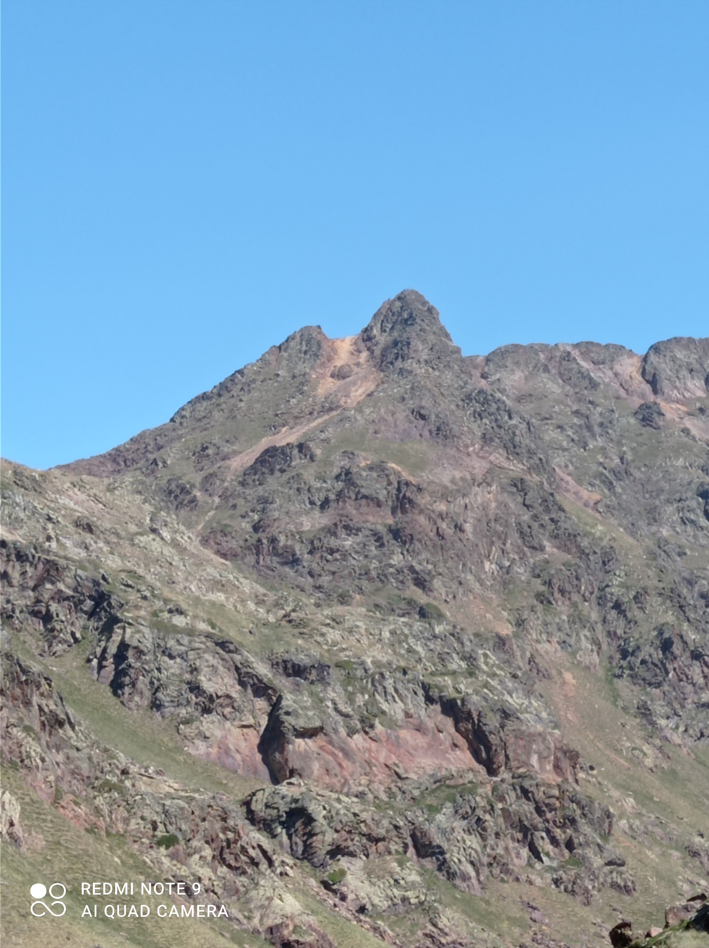
Closeup of the chute up T-Bolt peak. The annoying talus hopping section is also visible.


Another view of the route from the notch. This section is below the ramp. The ramp would be the red line near its top.

Palisade glacier from the summit.


The fun class 3 section after the ramp.

View south from the summit.


First summit view (and the bowl under it).

From the summit. Palisade Basin - right, Dusy Basin - left.


Looking down the chute from U-Notch.

Memories!


Sunday, July 24, 2022

Pica d'Estats

 I had been eyeing up a scrambling route (SE Ridge) on Pica d'Estats for while now. This is in the along the Spanish-French border in the Pyrenees. Pica d'Estats is one of the several 3000+ m peaks in that area that form a formidable ridgeline. This ridge is rated PD with technical difficulty level of  II+. That technical difficulty level would correspond to low class 5 in YDS. Don't ask me what PD (literally - Petit Difficile) really refers to - fuck do I know. Low enough technical difficulty that (with some experience on this kind of terrain) one would not need a rope and protection, but enough to demand attention. This scrambling part comes about halfway through. Before that, there are a few miles of trail (actual trail as well as faint use trail/goat track).

I got to the start of the trail at about 6:30 AM. I was using GPS for the trail part (it is not that useful in scrambling/climbing sections). Often, GPS is great to pin down the path. Not today - maybe the satellite gods were busy fighting Elon Musk. It immediately set me off in what turned out to be NOT the trail I needed. It sent me off on a side trail and, subsequently, on a steep uphill goat track. After I had been going uphill through some vegetation, it told me - sorry, you are 500 m off the trail. Que mierda. So, I bushwhacked down a steep slope to meet the actual trail. At this point, I had spent about 1.5 hours of steep hiking on (what I later learned) was15 minutes of an easy stroll trail. After another half a mile on this nice trail, the GOS again told me I was off. I knew I had to get off the main trail after a bit, so I gave GPS the benefit of doubt and scrambled up a grassy cliff. To meet the main trail again. Que mierda, de nueve.

I remembered that I was supposed to go off the trail soon to get on ridge and follow that ridge to SE Ridge noted above. This looked like the place to do that. So, I got off the trail and started hiking up through some steep grassy slopes. As I was getting closer to the ridge, GPS suddenly said - "oops, you are going to the wrong ridge. See the one to your right across the valley - that's it. Pinky promise this time!" What do they say about - fool me one, shame on you, fool me twice, shame on me?  Well, the shame was on me. Off I downclimb a horrible grassy/rocky slope clutching on to rocks and grass as I scoot down on my butt at times - for about 100 m vertical. I made my way up to the base of the other ridge and started working my way up that. Steep grassy slopes gave way to some class 3 scrambling. Finally I could see the first summit on that ridge. Ahh, here I come. GPS: "nope, I was wrong. Go up that shitty looking death col - you have to be there." I looked at where the GPS track was likely leading to. That seemed insane. What if I was on the right ridge the first time? I looked where I had come from. If the first ridge was the right ridge, I should be on THAT col and not the one the GPS seems to be leading to.

Can one be proud of not being fooled thrice? But first, I had to get down from this ridge to a lake now between me and the col I was aiming for. I didn't want to go back the way I came and lose all that altitude/mileage. So, I looked for ways down the ridge by gingerly walking to one rock outcrop after another and peering down. This one - suicidal, that one - just plain silly. Finally, I found a possible way down - a steep gully with some scree and grass. I stayed on the grassy parts when I could, and screed down when I had to, followed by a befitting 3 m class 4 step down a rotten chimney.

I found a goat trail with some cairns by the lake. This goat trail was leading to the desired col. I followed a nice stream for a while and started going up the steep slope to the col. There needed to be several breaks to catch my breath. Finally, I was on the col and I could see that, indeed, the next ridge from this col in the one I am supposed to go on to get to SE Ridge! The first part of the ridge was mostly easy class scree/boulders 2 with a couple of class 3 moves thrown in. This put me on my first peak of the day - Pic de Canalbona! It is just shy of 3000 m. Just a short break for Gu on this peak, then I was off.

I was prepared for the SE Ridge section being the hardest. But the section between Pic de Canalbona and Rodo de Canalbona required a fairly sketchy downclimb into a gully to bridge a gap. After that, a lot of class 1/2 easy, but steep, hopping led me to Rodo de Canalbona. My first 3000+ m peak of the day! From here, could clearly see the Pica d'Estats ridge.

The next peak on the ridge was Punta Gabarro (another 3000+). More class 2 tedium, but a nice summit. Then, a quick descent on the goat track to the col to the beginning of the said SE Ridge. From the col, I tried to look for lines of weaknesses in an otherwise unsurmountable looking ridge. I even looked at a pic of the ascent line that I had snapshotted on my phone. No luck, I have to try it out for myself.

At this point, I had to stay just very near the ridge as I traversed some easy class 3 slabs to where progress seemed impossible unless one was willing to solo mid-range 5's (which I wasn't). It took a couple of minutes of scanning the ridge to find a short class 4 chimney that led to the very crest of the ridge. I did remember from the route description I had read that at some point one gets to the very crest via a chimney. Since I was confident I could reverse the chimney (and everything that came up till now) if I needed to, I went up that chimney. 

After the chimney deposited me on the crest, there seemed to be another impasse. The description had something about a somewhat exposed step across as the crux of the whole route and there seemed to be an obvious one on the right side of the ridge. I scanned a bit more to make sure and saw a cairn across the supposed step. Voila! The step itself was fairly straightforward. I did not notice the exposure being particularly bad - however, I was very focused and thoroughly enjoying myself, and the climbing was well within my ability, that I may just tuned out any distractions.

What draws me to scrambling in the mountains is it naturally drowns out all the distractions. It is for me what, I suppose, is meditation for some. I am not really a "thrill seeker" - I don't even like jumping off a 3 m diving board or rappelling. Although I enjoy mountain views, it is not for those that I love going to the mountains. It is for the moments of that deep focus state that it brings that draws me to scrambling. There can be distractions while hiking or even while climbing technical rock with  protection/rope, but there is none while scrambling. In those moments, there is no extraneous thought - positive or negative - just the rock in front.

The section after that was fairly straightforward class 2/3 to the summit of Pica d'Estats. I had an ear to ear grin at the top - more so because of the fun on the ridge I had had than for summiting itself. Expansive views on all sides were quite nice and I had more water and some more food while sitting down an enjoying the views.

The nature of the civilization changed at the summit. From when I left the main trail fairly early to now, I had not seen a single soul. Now, there was a constant flow of people on the summit and the main trail beyond. This was the trail I was planning to take all the way down to the trailhead. Seeing how crowded it was, I decided to skip part of the trail by going down a goat gully to the col where it intersected the trail again. With this in mind, I hopped across to the next peak, Pic Verdavuer (another 3000+) and took the gully down from it.

This gully had cairns - so, even if not as much as the main trail, it was still travelled a bit. The gully started off fairly easy at class 2. However, I quickly encountered some tricky class 3/4 downclimbs that took some routefinding.

When I got to the col and intersected the trail again, it was a fairly straightforward way (~6 miles) down to the trailhead. There were several nice lakes and streams along the way. As I got closer and closer to the trailhead, the quantity of people who did not know the concept of "share the trail" increased. Anyway, I got to the trailhead without any incident.

The GPS was screwed, so I do not have actual data - but trying to recreate the route I did roughly on Strava, I estimated 13 miles and +/- 7000 ft of gain/loss. And, although I did not need Strava for this, a very happy middle-aged puppy.

Some pics below (in reverse chronological order).


Looking back at Pica d'Estats from the main trail

From the main trail - looking at the Monteixo ridge

Some of the chimney downclimb from Pic Verdavuer to the col

Views from the summit of Pica d'Estats looking westish

Looking back at the technical crux of the SE ridge route. The rock closest to the camera is where the step through was

Looking at the apparent impasse on the SE ridge. I took one of the chimneys closest to me at this point to get to the very crest of the ridge

An example of the exposure on the ridge (this was before the crux, but captures the essence)

Pica d'Estats!

Looking back the way I came - through the left valley.

The col I met the ridge first is on the left. Pic de Canalbona is the highest point in this pic.

At the lake after sketchy downclimb from the wrong ridge.

A nice waterfall on way to the wrong ridge

Monteixo to Comapedrosa ridge

Tuesday, September 29, 2015

Georgia Jewel race report

The main goal of this summer's running training was to make an attempt at the unsupported fastest known time (FKT) on the Tahoe Rim Trail (TRT). Lots of training miles on big hills with a pack on. As I was getting set for the final few weeks of training for the TRT, there was some rumblings about how it felt strange to do only one actual race this year (Cruel Jewel in May). Alicia suggested that I can do a 100 three weeks after the TRT trip - I would already be trained and can just coast for those 3 weeks. She found that Georgia Jewel (+/- 16.5 K ft elevation gain loss and several significanntly rocky sections) fit the bill quite well - plus no travel required. So, yeah, Georgia Jewel was an afterthought to the main event of the year - TRT.

As things went, the TRT FKT attempt was a bust. I bailed out a bit less than halfway (total is 173 miles) because of the slow going - whether due to the cold, altitude, or over-training without sufficient recovery. After about 84 miles (in 30 hours), I realized that I was going to be way off the FKT pace. And, had no interest in destroying my legs further just to finish the loop. With that, a 84 mile run at altitude became my last long training run for Georgia Jewel. Yes, there are substantial mountains in GA, but altitude is not ever an issue. Overkill, anyone? Oh well.

Closer to the race, when I looked up the entrants list, it occurred to me that I could actually place pretty high.  Still, this race being an afterthought, I never felt too excited. Then, three days before the race, I got a weird tweak in my right knee. Even the evening before the race, that knee remained a bit bothersome. I trucked over to Walgreens and bought a knee pad. When I later tried that pad, I found that a size S/M is not quite made for my legs. That did not stop me from using it during the race. To use a rock climbing terminology, it was my psycho pro - one that I had to pull up an adjust every 5 miles. Yes, it was that kind of race at the start for me. And, it started at 5 am (ughh).

The first 2 miles of the race are on pavement going uphill, and that allowed the field to thin out quite a bit. After that, a very rocky single track for several miles (aptly named "rock garden"). The trail eased up a bit after that till the first full aid station (mile 10). From that AS to the next - Snake Creek Gap (mile 17), I ran a fair bit with another runner, Richard. We got to mile Snake Creek Gap at about 8:30 AM. Between that and the next full AS (John's Mountain - mile 25), I felt quite good and pulled ahead of Richard. For the last half of this section, I ran into several 35 mile racers coming the other way. The resultant constant stream of mutual cheering meant that I arrived at Johns Mountain AS in good spirits, despite a gnarly half mile section of rough rock steps towards the end of this section.

Things went well for most of the next section. Well, except for a bit on gravel road with roughly strewn golf ball sized gravel. It was here that I started running into the 50 milers coming the other way, and learned that I was in the 3rd place. I hadn't really thought about the place till then, and just figured that the first two people must be quite a bit ahead of me. Although I was maintaining a steady pace, I didn't think I was going particularly fast. In fact, I was beginning to feel that my legs were not fully ready for this race so soon after getting beaten up on the TRT. Accordingly, the thought of speeding up to try to catch up with the leaders didn't sound very exciting.

A couple of miles before the next full AS (Manning Rd - mile 34), my legs started to complain (my knee was still doing okay). I had already decided before the race that two aleves are all I am allowed. Hmm - I am a third way done. There goes the first one. These two miles and the next 3-4 miles after the AS were the low points, It took a lot of mental effort to keep moving, but the thought of losing the 3rd place kept me trudging along. That, and the thought of pumpkin pie waiting at the Narrows AS (mile 40). The final few miles to that AS are on the road and utterly horrible. If it were not for the aleve kicking in at the right time, it might have been very tough to continue.

Anyway, the aleve kicked in and I got to the Narrows in reasonable spirits. It was good to see Molly, and even better to have the pumpkin pie. Oh wait, did I just mention my mental ordering out loud? At that aid station they told me that I was now in the second place (one of the leaders had dropped out), and was only 10 minutes behind the first guy. That did it - I was going to race from that point onwards.  I had never been so close to the leader in any ultra I had done. I settled into a routine - power walk uphills, run downhills, and alternate between power walking and running on flats. It was going well till I got within 1.5 miles of the halfway (turnaround - since it is an out-and-back course). Power lines, dang it! Fairly brutal.

About a tenth of a mile before the turnaround, I saw the first guy coming the other way. I had indeed closed the gap by a few minutes! When I got to the turnaround - Alicia! She quickly refilled my water, and I took off after drinking some coke at the aid station and grabbing a rather large slice of pizza to take with. The section from the turnaround to the Narrows aid station (mile 60) went smoothly. Not too far after the return trip over power lines, I ran into the 3rd guy coming the other way. He seemed to have made up some time over me. That pushed me further and I increased the running time to walking time ratio on flats a bit.

Then, at about mile 58, I took the lead in an ultra for the first time in my running career! At that point, of course, I did not know if I will be able to keep the lead for too long, but that was pretty exciting. Also, as I was catching up with the other guy, I noticed that I was a bit faster on uphills and he was doing downhills somewhat better. That knowledge could come in handy later, I thought. I got to the Narrows AS about half an hour later, and Alicia and Molly quickly refilled my water as I munched on some food. They were excited to see me get there in the lead. However, I wasn't quite the model guest who would stay and exchange pleasantries - I left almost immediately. I wanted to leave before the other guy got to the AS and, maybe, gain some psychological edge.

I thought I was doing well between the Narrows and the Manning AS, but he caught up with me at the latter AS (mile 67). Then ensued a back and forth tussle for the lead for about a mile. Here, the knowledge that I was a bit faster on uphills gave me a mental boost - most of the section from the Narrows AS to Johns Mountain (mile 75) is uphill! Soon, I stopped seeing his headlamp behind me. Despite the uphill, I made it to Johns Mountain in a reasonable time. I did not have a watch, so I asked one of the AS volunteers the time. It was 11 PM. My original desire of under 24 hours was very unlikely at this point - with 26 miles remaining in 6 hours, when I had taken 5:15 for the reverse segment at the beginning of the race. The main goal, now, was to keep my lead.

With that goal in mind, I changed my headlamp batteries, changed my socks the third time (a few stream crossings on the course), surveyed my long list of blisters (at least two on each foot), grabbed a grilled cheese sandwich from the AS, popped my second aleve and set off. Despite the rocky steps, the first downhill section went fairly quickly, and soon I was into the rolling section for a few miles before the climb up to Horn Mountain. The descent from Horn Mountain to Snake Creek Gap was pretty fun - with a fairly smooth trail and the aleve kicking in. I made it to Snake Creek Gap about 1:10 AM. There, I learned that the second place guy was 20 minutes behind me at Johns Creek. Although it felt good to gain some time on him, the race was far from being over with more than 17 miles still remaining. One bad segment for a few miles and he could easily catch up with me. However, I sat down on a chair at the AS for a few minutes - for the first time in the race - while Alicia fed me my elixir (a cold starbucks bottled frappe). 200 calories of pure joy (read, sugar) and 200 mg of caffeine. I had only had a couple of small cups of coke till then in hopes of an extra kick at this aid station.

By 1:15 I was on way. Alicia was going up the first mountain with me. She was pretty excited about my lead and thought I probably had the race in the bag. I was getting cautiously excited. The first climb went pretty fast, then Alicia had to go back. I chugged along at what I thought was an okay pace for a bit, before slowing down. There was a fair bit of pain at this stage - especially with the blisters bursting left and right and starting to bug me a lot. When I got to the next aid station (mile 91), I had taken 1:45 to do the last 7 miles. I asked the volunteers at the aid station if they had heard anything about when the second guy left the last AS. One of them said that two guys have left the last aid station after me.

"Do you know how long ago they left the aid station?" I asked.
"Not that long ago. Maybe an hour and a half ago."

Uh-oh. If I left 1:45 ago, and the second guy left about 1:30 (meaning 1:25 to 1:35, maybe), then I may just have a 10 minutes lead now! I better get my act together! For the next several miles, I was running whenever the rocky sections would allow me and sometimes even run on the rocky sections with not much regard for ankle twists or anything. Once in a while I would look back to see if there was a headlamp behind me. A couple of times, as I looked back, my headlamp would reflect on the trail blazes and I would panic thinking that it was a headlamp. Power walk, run, run some more, power walk up the hill, barrel downhill, and don't even think about stopping to pee. When I got to the rock garden, I could only walk for a while and I started having the mental image of the second guy blazing by me. Oh well, try to run again. After what seemed like an eternity, I emerged from the singletrack and onto the dirt, followed by the paved road. These last 1.5 miles were pretty horrible - downhill on hard pavement, with my bothersome knee acting up a bit and the burst blisters. I could not slow down - I had no idea how far behind the second guy was! Finally, I saw the finish area about a couple of hundred yard ahead, and looked back one more time. I saw no headlamp, and was now fairly sure that I will win the race. Later, the results showed that I won by about 2 hours.

So yeah, 24 hours and 29 minutes after starting, I got to the finish. Any remnant disappointment at spending the whole summer training hard for the TRT with nothing to show for it disappeared. I realize that 2015 was not the most competitive year for Georgia Jewel, but screw that - I won my first 100 mile race!

Sunday, May 17, 2015

Cruel Jewel 100

“I am going to cut off my f*****g piece of s**t hamstrings and feed it to the raccoons!” That thought imprinted very vehemently on my mind as I stomped my hiking poles on the trail in the middle of a 1200 feet steep climb starting out of Old Dial Road at mile 75ish. Two points of note here – one, luckily, I did not have a knife/machete/sword/epee etc. Two – the use of the word “steep” in the previous sentence is superfluous when describing any section of the Cruel Jewel (CJ) course. The course is 108 (or, thereabouts) out-and-back with over 30K ft of elevation gain/loss. The course website says 33K ft – I am not sure about that number, but I won’t argue too much. It is a hard course, but not particularly technical. There are some occasional rocks/roots, but, for the most part, the trail is very runnable. On the downhill sections. Last year, I did CJ, but the course was what I considered a baby CJ course. Due to rains (and general BMTA a**holery), they had to reroute the “back” part of the “out-and-back” through a significantly easier section. Accordingly, although I officially did CJ 100 last year, I thought I had cheated to gain the finish.

So yeah, fast forward to 2015, and here I found myself at the CJ 100 starting line. Coming off of several good training runs, including doing SCAR a month ago, I was feeling pretty good. I had set myself a very challenging goal time of 30 hours (time limit is 48), and that (and adrenaline) played a bit of a role in the first section of the course – 21 miles from Vogel State Park to Skeenah Gap. A subsection of this – about 4 miles between Fish Gap and Rhodes Mountain (~mile 20) – is probably the hardest part of the course with the climb up Rhodes being pretty ridiculous. I thought I was not pushing myself too much, and still I found myself at Skeenah in under 5:15. That was almost half an hour faster than I had ever done that section! On the plus side, I got to run a bit with Kevin (from Philly) and Lee (from Akron) for a bit on this section, and that was fun. Another exciting part was getting to the Fish Gap AS and diving into the scones that Molly made. As I rambled down to Skeenah Gap, I saw Alicia. I wasn’t expecting to see her for another 5 miles – so that was a pleasant surprise.

I was feeling pretty good at this point, and the feeling stayed on till the next aid station at Wilscot Gap. Mostly – I started having some issues with my stomach. It had been pretty muggy (80ish and humid), and I may have had more neat water than I probably should have had. And, then, came the first signs of rosy things not continuing to be so. The next section between Wilscot and Old Dial road (miles 26 to 32) went much slower. Correction – the section between Wilscot and Deep Gap (26 to 42) was fairly slow. My hamstrings started complaining (although not the point stated in the beginning of this post), and I had to bite the bullet and take alleve around mile 40 – sooner than I would have liked. Just after Old Dial Road, Lee and, then, Kevin passed me and I think I was quite grumpy at that point. I tried to keep up with them, but they were faster (probably to escape a grump).
Descending to Deep Gap, I saw someone running up the trail faster than I was going down it. Karl Meltzer was already 18 miles ahead of me! I stepped aside and said “good job” and got a dismissive “thanks” in reply. Oh well. After deep gap, I got to a very annoying part of the course – Aska Lollipop done counterclockwise. Now, this section is quite fun going clockwise, but awful the other way. All the nice smooth downhill sections in the clockwise direction are now unrunnable uphills.

 The last 3ish miles to the turnaround are on the road, but not too bad. There I was – 13:15 hours after the start to the turnaround. On the way back, there is an extra 5ish mile section – so, I was not quite halfway. Still, I thought I had a reasonable chance at being under 30 hours. And, then (well, not immediately) came the section between Old Weaver Road and Stanley Gap. Halfway between the two gaps (mile 66ish) just before the sun came up, I started having a lot of trouble staying up. I got passed by Kevin and another guy (I will call him the Bostonian due to the way he pronounced “coffee”), and they both seemed a bit concerned about my state. I assured them it was just a passing phase and I would feel better once the sun came up. And, soon it did and so did I. Things from there back to Old Dial Road (mile 75) went reasonably well, and I caught up with and passed Kevin.  And, then, came the climb up on BMT (Benton Mackaye Trail) from Old Dial Road with its cutting-of-the-hamstrings shenanigans. Somehow, I managed to crest the climb just before the downhill into Wilscot Gap.

At Wilscot, I caught up with the Bostonian and he was surprised to see me – he said he thought I was done with when he had passed me at dawn. I guess, I might have been – had it not being for my quads strengthened by countless feet of jarring downhill on SCAR a few weeks ago: I could still maintain a decent pace on downhill sections. As I started up from Wilscot, I soon ran into Alicia who was doing her run backward on the course from Skeenah. That really perked me up and the section to Skeenah went pretty smoothly. There, Alicia gave me my elixir –  ice cold Starbucks frappucino! I checked the time – I had just over 6 hours remaining till the 30 hour mark. That was going to be tough – 21 miles on (mostly) the Duncan Ridge Trail. But, maybe… Let’s just give it a try.
In the section between Skeenah and Fish Gap, I passed two people, and surprised myself by taking just over 1:30 on this section. Still a chance to get under 30 hours! Then, things got bad, and I took almost 3 hours to get to the next aid station at Whiteoak Stomp (almost 8 miles). I had to take a short break midway to pop my second alleve of the race.

In the state my hamstrings were in, I was dreading the climb up Coosa. But, I didn’t realize I had a secret weapon there – Alicia had turned up at that crew stop and offered to go up Coosa with me! It was slow and painful, but I was perked up now to make up Coosa without too much whinging. On the big downhill (about 2200 ft in about 4 miles), I realized that my tired quads still had enough juice and I ran down at a reasonable pace. I caught up with Lee and someone else halfway down Coosa. I was reasonably buoyed up at this point that even the most annoying section between Wolf Creek and Highway 180 (3 miles of uphill that it just steep enough to not being runnable, but you don’t really feel you go anywhere) did not damped my spirits too much. And, then final mile. I was in a lot of pain, but tried to make it a sprint finish (or, what felt like one). Final time 30:44 – a bit over what I had myself a goal of, but still very satisfied with the result.

With the slow going and pain at mile 40 before the first alleve kicked in, I was toying with the idea of dropping out. But, as someone formerly famous once said – “pain is temporary, regret is permanent, and drugs take you far.”


PS: There were reports of course marking being tampered with on the Benton Mackaye Trail. Given how much BMT Association (BMTA) hates runners and their ongoing efforts to ban races (or, probably even anyone going over 1 mile/hour and not carrying a 60 lbs pack replete with banging pots and pans hanging outside), I would not put it past someone from BMTA doing that.

Sunday, April 19, 2015

SCAR

Lately, I have been sort of moving away from racing ultras and doing long, seemingly pointless, runs on my own. I am not fast enough to be even remotely competitive in organized ultras and I get similar (or even more, in some cases) satisfaction in finishing a hard run. Last year, it was the JMT, and this year, so far, it was SCAR.

SCAR is short for Smokies Challenge Adventure Run. In general, I shy away from things that have the term "adventure" in them officially. Or "tough" or other words that convey a similar sentiment. However, SCAR is not an organized event, and the acronym is just a stand-in for something really cool - run across the Smokies on the Appalachian Trail in a day. So, 72(ish) miles with +/- 19000 ft of elevation change. With aid/crew/bail out only accessible at about halfway, it is a bit committing. I decided to do it northbound - starting at Fontana Dam and going to Davenport Gap.

Before the run, I had been pretty apprehensive - weather looked a bit iffy, bears usually just wake up hungry around this time from their winter slumber, and so do snakes (copperheads and timber rattlers in the Smokies). I am mortified of snakes with diamond heads and oval eyes. But, I knew that once I started the run, I would feel better, and the statistics are on my side, anyway - no hiker has yet been eaten by a bear or a snake on the AT. As far as training, I felt pretty good - had trained quite a bit on hills this spring. However, I had never run this section of the AT - so, that was unknown,

On Friday (April 17) evening, I made Alicia drive me to Fontana Dam (1700 ft) to drop me off. I started from Fontana Dam visitor center at 10:42 pm and entered the boundary of the Smokies on the AT at 10:49 pm. The first several miles on the AT are uphill, but very gradual, and the trail is pretty smooth. However, despite the gradual feeling nature of the trail - one quickly gets to above 4000 ft (and remains above that for most of the time). I wasn't pushing myself at this point and thought that if this type of trail continues, this is going to be a way easier run than I had thought. As it turned out - I was very wrong. The "fun" starts with the climb to Rocky Top (or, some name like that), just before Thunder Mountain, and keeps on till the end. The overall thing is quite brutal - no wonder it is worthy of being called a challenge.

It had rained quite a bit recently, and the trail was very muddy. That was not an issue on the gradual parts, but as soon the trail angle became steeper, the slick muddy trail led to a fair bit of sliding backwards and wasting energy. When that started to happen, I rued my choice of shoes for this first section. So, yeah, the trail not only got inherently harder, but also became more slippery. Either due to having to work more due to the slippery trail, or due to some flaw in my stride, my hamstrings got pretty tired by mile 25. Great - only 47 more miles on tired hamstrings. To keep my spirits up, I kept telling myself that the final 5 miles are all downhill (3000 ft drop in about 5 miles at the end), and my quads are still quite good.

I didn't see any bears or snakes. I saw several frogs on the trail. However, they seemed unfazed as I passed by them - they didn't even attempt to move when my feet hit the ground mere inches from them (narrow trail). It was slightly disconcerting to me - I can't even scare a frog, so what chance do I have against a bear or a snake?

As the sun was coming up, I realized that I was going to be a bit behind schedule (I had told Alicia to expect me at Newfound Gap - the only crew stop at mile 41ish - around 12 hours after dropping me off at Fontana) - but probably by not a lot. However, as the morning progressed, I started to feel sleepy and the going got to be a struggle for a while. Time for a caffeinated Gu. After the gel kicked in, I recovered. However, more time was lost by then, and I got to Clingmans Dome (~6600 ft) about an hour or so after I had expected to be there. On the plus side, the views from the trail were absolutely spectacular. A bit after Clingmans Dome, I ran into Alicia running up from Newfound Gap. We, then, ran to Newfound Gap - about 13.5 hours after the start, where actual food and coffee was waiting for me. I changed into my Hokas to get ready for the downhills. As I sat dawdling at the stop for a bit longer than necessary, Alicia kicked me back on the trail - "Onwards!"

The second segment began with a big uphill. And. although the net change from Newfound Gap to Davenport Gap is about minus 3000 ft, the most of the net loss is at the very end: there are still very significant climbs for a while. The trail is mostly pretty decent too - however, my trashed hamstrings meant that I could only run downhills and uphills were a slow shuffle. When I tried running the few flat sections that were there, my hamstrings immediately started complaining.

The slow going was getting to be frustrating (maybe I should just accept the truth and embrace the name of my blog), and I decided to try something different. So far, I had been using hiking poles. I stopped using them on uphills to see how that would work. After a bit, I realized that my average pace had inched up a bit (on an equivalent terrain). Hmm - maybe my use of the hiking poles is inefficient. People sometime ask me (and other distance runners) what I think when I am running. I usually say that whatever catches my mind at that moment. Analyzing my hiking pole usage is a prime example of that. Anyway, from that point, I used the poles only for rough downhills (of which there were plenty towards the last part of the trail).

About 10 miles from the finish, I thought I had a shot at finishing in just over 22 hours. I even texted Alicia such an optimistic time (there are a few places on the trail that one can get cell signal). Then, began the first of the two big descents. The first one was very bone jarring - several jump downs over big wood steps. I could still go at an okay pace for a while, but soon, the pain of repeated jumps over wood steps took its toll. I slowed down a bit more - but still though I had a chance of being under 23 hours. However, on another downhill section, I twisted my gimpy ankle a bit. That made me slow down substantially - more out of being careful than due to any issues with that ankle. For the next couple of miles, things started to fall apart. I probably was going 2 miles an hour on the top of the last downhill for a bit. Then, I realized that if I don't get my act together, I will miss the 24 hour mark! That spurred me and I started running at a reasonable pace again. About a mile from the finish, I saw a headlamp on the trail. Alicia! At 10:15, I got to Davenport Gap (2000 ft) - well and truly scar'red - everything hurt. But, glad to be done - even though I was a couple of hours slower than I had planned. Still, (barely) under 24 hours (23:33 or 23:26 depending on where the counting started - Fontana Dam Visitors Center or just after the Dam at the apparent boundary).

In hindsight, I made two mistakes. One - starting so soon after all the rain. The muddy trail was quite slippery in the first half, making me work significantly more on the uphills. Two - inefficient use of hiking poles. My natural tendency is to have big arm swings. However, that translates to farther apart hiking pole placements, In turn, that leads to taking bigger, hamstring unfriendly, steps on uphills. Either I need to practice using hiking poles more efficiently or not use them at all on uphills. Well, add a third mistake - using my piece of s*** Salomon shoes for the first half. I chose them for the night section because they have high ankles for added support that is pliable enough for an easy jog (I wasn't planning on anything more than an easy jog at night). But, the sole rubber is pretty bad - these are trail hiking shoes with no traction on anything other than probably bone dry fire roads. Or, maybe, not even on those.

Despite the pain and the muddy unpleasantness, it was still fun. And, I would probably try it again (maybe southbound next time) at some point.

Tuesday, August 19, 2014

JMT - aka, Whitney the long way


“Previously on John Muir Trail: he had to bail out about two-thirds of the way in. When he bailed out, he thought that the last third must not be that much tougher than the section he had just experienced…”.  Unfortunately, unlike your favorite TV show, the current season could not start where the previous season had ended: I had to start from the very beginning. On the plus side, I am glad that I had not bailed out last year after Mather Pass: if I had, I would perhaps never have tried again this year. So, at the risk of spoiling the suspense, I should say that the last third is way tougher than the first two-thirds. And, with the sentence, I apologize for spoiling the overall ending too. But, if you do read on, you’ll get to see some cool foot after-picture.

So, some preliminaries – the John Muir Trail is the Crown Jewel of High Sierra trails and runs 211 miles from the Happy Isles trailhead in Yosemite to Mt. Whitney in California. And, it is not flat. I had tried it last year and had bailed out just after Muir Pass because of some issues – I have a blog post about it here. When I had bailed out, I had thought that I would never try it again because I did not enjoy the experience at all: despite some of the most spectacular scenery I had come across - going 40+ miles each day gets to be painful and leaves no time to actually enjoy the scenery. I am not sure whether Alicia believed it when I told her that I will never try it again.

Out rolls another spring, and I start training for a hard 100-mile race (Cruel Jewel in GA). I trained hard for it, and not just because of that race itself, but with another JMT attempt in mind. After the race in May, I switched from doing long runs in the north GA mountains to doing even longer runs/hikes in those mountains with a 20 lbs pack. By the beginning of July, five weeks before my trip,I was feeling quite strong and better prepared than last time: no disrespect to WI (where we lived last year), but it is a tad flatter than northern GA and High Sierra.

Then, the trip almost didn’t happen. While on an easy run in a recovery week, I twisted my gimpy ankle badly. Subsequently, my grand training plans for the last few weeks had to modified - just fast hikes in the mountains now, and only one of those hikes were what I would consider long enough for JMT training. Even a few days before the trip, I could not finish a hike without significant discomfort on the ankle. Alicia had suggested I try ASO ankle bandage, so I took the advice and decided to use that. A week before the trip, I tried the ankle bandage for a couple of 2-3 hours hikes at a local trail. My ankle survived 8 miles without any pain, so I must be ready for 211 (+11) miles on some very rugged trails.

I got to Yosemite Wilderness Permit Station early morning on Saturday, August 9 to try my luck at one of the few walk-in permits available each day. There were a few of us who got the walk-in permits that day: a couple from Sacramento (Phil and Nancy?), and a young guy from all over the place (originally from Atlanta). We talked for a while, and they probably thought I was a lunatic to try and go 40-45 miles a day, unsupported. But, they were nice about it, and I enjoyed the morning company.

The whole of Saturday, I was feeling quite “meh” about the whole thing. Recent medical issues had dampened my enthusiasm and the trip seemed doomed. I really did not have much excitement about the whole thing till about 4 PM (I was going to start about 4 AM next day). If there was a bet going somewhere as to when I would bail, I would have put my money on Tuolumne Meadows (the first actual bail out point). Then, I took a shuttle ride around the valley. When the shuttle got to the trailhead, I saw the sign – “John Muir Trail”. That was it – I felt goosebumps. Maybe, I would have now bet on Devils Potspile (the second easy bail-out point at mile 56).

Day 1 (~46 miles): I got to the trailhead at 3:57 AM and started hiking. It is basically all uphill for the first 20ish miles till Cathedral Pass. Along the way, I met an Indian guy (Aditya) – I am sure he was as surprised to see the specific ethnicity of another solo hiker reasonably far from the trailhead at 5 AM as I was. We had a pleasant conversation for a while – he was heading up to Clouds Rest. After a while, my strapped ankle started to feel a bit funny. The bandage is stiff enough to prevent much lateral motion and prevent a roll, but the natural constant flexing of the joint while walking/running did create some discomfort. Also, the bandage does rub against the Achilles, which got more and more inflamed as the days progressed.

Other than the ankle issues, the day went quite well till I started up Donohue pass (about 34 miles in). The pass itself defines the boundary of Yosemite National Park, and its summit is almost 11 K feet. That translates into – I can’t breathe and am nauseous. Well, maybe not the “park boundary” part. I realized that I had taken some Zofran with me (an excellent suggestion by my wife). The nausea went down and I was able to eat. I still couldn’t breathe and I did slow down considerably.

When I started up the next pass – Island Pass – it was already way into the night, and I hiked a bit more till I got to Garnet Lake. A bit around and above the lake, I decided to stop for the first night.
One thing I hadn’t accounted for was the amount of time it took to get ready for bed – force feed myself, put the remaining food in the bear-resistant container I was carrying, setting up the bed. And, being tired made all that take that much longer. Eventually, I got to sleep about 1:30 AM.

Day 2 (~33 miles):  After getting up at 5, it took me a while to get ready – get the day’s food out of the bear container, have some breakfast, pack sleeping stuff.  Eventually, I got going about 5:30. A short downhill, followed by a bit of uphill, and the subsequent downhill got me to Devils Potspile. Then, a slog up on an exposed trail during the hot part of the day led me to Crater Meadows, then a more shaded trail to Duck Lake by mid-late afternoon. A few more rambling ups and downs lead to Tully Hole. It was here that it first started to hail, and I could see lightning on the higher passes and peaks. About here, I met another hiker (Sean?) who was trying to finish the JMT in under 8 days.  We talked for a bit, and he camped and I carried on.

My original plan for the day was to make it to Quail Meadows (~ mile 88) before taking a break. Unfortunately, as I was making my way up to Silver Pass before the eventual descent into Quail meadows, it started to hail on me again, and I noticed that it was mainly the Silver Pass area that was completely covered in a threatening-looking cloud with thunder. It was only about 11, but the cloud did not look like it was going anywhere. So, instead of either wasting time waiting for the cloud to go away or, the more dangerous option, getting hit by lightning on Silver Pass (~11K ft), I decided to bivy half way up Silver Pass with the plan of waking up earlier.

Due to possible rain all through the night, I set up my tarp-tent. It was a piece of pure artwork (pic below) – less tolerant of wind than Scottish midges and rain than a cheap climbing guidebook. Needless to say, I had to get rid of it within the first 15 minutes and take my chances with the rain. Luckily, it just drizzled a bit, and I was able to manage about  3 hours of sleep.

The "tent".


Day 3 (~44 miles): The plan for the day was to get up by 3 AM and try and make up for the lost mileage the day before. The first part was successful, but I had only a qualified success in the second – I needed a 50 mile day.

It started off quite well – I got down to Quail Meadows at a reasonable pace and managed to get up the big climb up to Bear Creek Trail fairly quickly. Last year, this particular climb lead to a bonk, but it went much better this year. I suspect  all the hill training in northern GA had something to do with that. Then, up to Seldon Pass (~11 K ft), and down to Blayney Meadows trail junction. Last year, I had cut across to Muir Trail Ranch to resupply (by August, they have enough leftovers from previous hikers). This year, I was determined to do the trail in a completely unsupported fashion. I skipped the side trip to MTR and kept going towards Evolution Meadows. 

Just before dusk, I had my first scary moment – I felt a sharp tinge on the side of my gimpy ankle. I sat down on a rock and bent over to remove my shoe, the ankle brace, and the sock. Ah, it is just an oozing blister. Whew. Then, I felt my Achilles region where the brace was rubbing – there was a bit of a painful lump. I put the shoe back on and straightened up to start standing. Ouch – that was a sharp pain in my abdominal region, like a back spasm.  At this moment, I thought to myself – “it sounds ridiculous to go forward, instead I should probably hike out from Muir Trail Ranch to Florence Lake and bail. Then, another voice inside me said that the back spasm was probably due to something from my pack digging into my back.  Since I have already spoiled the ending for you, you can guess which voice won.

Getting into Evolution Meadow proper involved a choice of possible ways to cross a raging Evolution creek. I decided upon the least scary – a careful act across two logs onto the spine of a big rock. From that rock, a short hop put me on the other side. To make it about 50 miles, I had to make it to almost Muir Pass. But, the going was fairly slow now as I was tiring. So, I decided to stop somewhere just past Mclure Meadows.

Before stopping, I had my second scare for the day. As I was shuffling across the lower Evolution basin, I looked across a small meadow and saw two bright eyes staring at me. The two eyes seemed a bit too far apart to be deer eyes. And, in the moonlight, the coat seemed too light to be a black bear’s coat. Mountain lion?? Appear BIG and make noises!! I resisted the urge to gallop, pulled myself up and puffed out my chest to present my most imposing frame to the animal (hey, even a skinny 6’1” frame can be made to look big).  And, started banging my hiking poles together. I saw the animal take two steps forward to get a better view. RESIST THE URGE TO RUN! To fight the panic, I visualized my obituary – “DNF – mauled by a mountain lion.” Suddenly, the animal lost interest, turned around and left. If that was actually just a deer, it must have been amused by the silly human antics. I hope it was not just a marmot.

As it was a bright moonlit night, I decided to forgo setting up my tent and slept under the stars in my sleeping bag.

Day 4 (~32 miles):  The day started with a climb up to the upper Evolution basin. It is a very pretty region, but is followed by a soul-destroying climb up to Muir Pass (~12 K ft). It is a fairly gradual climb, but one has to hop across one large basin after another large basin to reach the pass. There were several early morning hikers here trying to make their way to the pass. Among them was a writer from Japan who comes to do the JMT every year. 

The climb up Muir pass is followed by a knee shattering descent into LeConte Canyon (~9 K ft at its lowest). As I neared the low point, I was stopped by a couple of trail volunteers who said that they were blasting some large tree that had fallen across the trail. They didn’t warn as to how loud the blast would be! 

Soon, we got going and I passed the point where I had bailed out last year. With a cursory glance up the bail-out trail, I kept going on the JMT. I was on a mission to reach Pinchot Pass that night. Unfortunately, as it transpired, there was going to be no parade on top of a pass proclaiming “mission accomplished”.

The trail went gradually uphill to Dear Meadows, and, then, all hell broke loose. The climb to Mather Pass is divided into two segments – the first is the so-called Golden Staircase leading up to Palisade Basin. Then, after some meandering around the basin, the trail climbs steeply up to Mather Pass (~12 K ft).

It was a slow climb up to Palisade Basin, and I realized that I was slowing down. When I got to the Palisade basin, all the frustration at the slow going immediately evaporated. The Palisade region has always been my favorite region of the Sierra – rugged peaks on three sides, with North Pal and its friends right in front as one gets to the basin from the JMT, and beautiful lakes. The picture, though nice, does not do justice to this region. It dawned upon me that I missed this region very much and it was somewhat of an emotional homecoming for me. Or, maybe, that was just the pain.


View of the Palisade peaks (Winchell, Thunderbolt, Starlight, and North Palisade) from the Palisade basin.


As much as I wanted to spend the rest of the evening there, I knew I had to carry on. Or, stumble on – as it turned out to be. Here, the progress up to Mather Pass was really slow. Of all the Sierra Passes, I think the climb up to Mather Pass is the hardest of all JMT climbs – big steps on a big rocky trail. And, the summit of the pass just keeps getting farther and farther the higher one climbs. Actually, calling it a pass is kind of a misnomer – it is practically a ridge crossing at the lowest point on the ridge. I decided to rename it Madar Pass. From that point onwards, I referred to the pass by its new name to anyone I met on the trail. And, since I did not meet any more Hindi-speakers on the trail, my insistence on using the new name was sort of silly.

When I finally got to the top of the pass, I found that the other side is much easier – just a short initial steep section followed by a gradual, runnable downhill. I felt I needed some sleep and that I would be able to use the runnable section to a better advantage after some rest. So, I set up camp just below 12 K ft on the south side of the pass around midnight.

Day 5 (37 miles): Ah, the joy of sleeping under stars – especially when you are at 12 K ft, have a down sleeping bag and it gets completely soaked in dew. I guess, I woke up colder than I had anticipated. And, since I would have no way to dry out the sleeping bag (unless I decided to take an hour break in the middle of the day), I knew that sleep the coming night would be kind of challenging.

Let’s worry about that later – for now, let’s enjoy the jog down some fun terrain to 10 K ft (South Fork of Kings River crossing). Those 6.5 miles went fairly quickly, and, then much steeper climb to Pinchot Pass started – again in two section, with a basin halfway up. Compared to the previous climb, the climb up Pinchot Pass, though steep, was fairly pleasant with a much smoother trail and not many steps. The view from top was quite nice too (pic below). The climb was followed by a fun descent down to the Twin Lakes Basin.

Looking down towards Twin Lakes from Pinchot Pass.


Unfortunately, the fun stopped there. The next section from Twin Lakes to Woods Creek is a hot and exposed section with annoying downhill footing. Also, it was here somewhere that I ran out of all my non-perpeteum food (except three Oreos that I was saving up for the Whitney summit celebrations).
After a cool (and scary) swinging bridge over Woods Creek, the climb up to Rae Lakes is, again, exposed and hot. The view from Rae lakes is quite nice, and I stopped there for about 15 minutes to take in the view and snap a picture or two. Although the area looks nice, I could kind of see the upcoming climb up to Glenn Pass (~12 K ft - the faint ridge just to the left of the hulking giant on the upper right of the picture below).

Rae Lakes area. The brooding dark hulk center right (and far) marks the leftmost edge of the ridge making up Glen Pass.


As has been the story recently, this climb was, again, in two parts. The first part was steep, though reasonable. The second part – there was nothing reasonable about it. The rough trail became even rougher till it just looked like a pile of rubble, with the steepness to go with it. Eventually, I got to the “pass”. Even more than Mather Pass, it was just a ridge crossing that was barely 5 feet wide at its widest.

Glen "Pass".


The descent down the other side was more pleasant, and quickly deposited me down to Vidette Meadows (except for the 3 K ft of knee busting). Along the way, I chatted with a couple of guys who had climbed the pass just ahead of me. Together, we made fun of the “pass” nomenclature to describe that monster.

From Vidette meadows, the next pass is Forrester Pass. At ~13 K ft, it is the highest of JMT passes (not counting Trail Crest by Whitney).  The first section of about 4 miles is fairly gradual, followed by an ever-steepening climb up to the summit of the pass (another ridge crossing). 

This was another theme on the JMT – the trail shape after Muir Pass is mostly concave. A gradual middle section surrounded by ever steepening climbs to summits of the passes. So, although the trail from the lowest point between two passes to either pass climbs a reasonable 3 K ft in 7 miles, two thirds of that elevation gain appears in the final third interval.

Eventually, I got to the summit of the pass and made my way down the other side to a camping spot. It was about 3 AM and it would be 5 days in just an hour. So much for under 5 days - I was still about 20 miles from Whitney. However, I had known for about 1.5 days now that under 5 days isn’t going to happen and was pretty happy to do 3 huge passes in a day.

 I had planned to sleep for about 2 hours. And, then, I pulled out my sleeping bag and realized that it was still wet. Uh-oh. Maybe the emergency blanket would suffice. Well, it did for about half an hour before I woke up shivering badly. 

Day 6 (~20 + 11 miles) “aka – everything tastes like perpeteum”:  The breakfast consisted of – you guessed it. The day started with a big, though nice, downhill to Tyndall Creek. The creek crossing was itself a bit tricky with raging waters.

The next few miles give much different scenery than the first 195 miles of the JMT – now it feels like a high desert environment.  There are still streams and occasional lakes – but vegetation is sparse and shrub like for the most part. And, the next 10-12 miles to Guitar Lake are pretty annoying with a few tricky stream crossings (I had to wade barefoot across Wright Creek because the rock bridge placement felt quite insecure). It was somewhere along this section I started having some auditory hallucinations – I began hearing cheesy Hindi music. And it annoyed me that I could not make out the lyrics!

As I was leaving Guitar Lake, a woman just got there and asked which lake was that. I replied “Guitar Lake.” She retorted – “No it is not.” Well, you figure it out for yourself then, I said to myself and left. I had a while to go and did not feel like engaging in a conversation with someone whose natural tendency seemed be “confrontation first”. It was broad daylight with several other hikers nearby, it was not as if things were on the verge of catastrophe anyway.

The climb up from Guitar Lake to Trail Crest is long and steep – climbs about 2 K ft in a bit over 2.5 miles. However, the footing is quite good – so, the climb goes relative quickly (expect for the lack of oxygen – Trail Crest is ~13.5 K ft).

At trail crest, the trail becomes  a zoo – it meets the main Mt. Whitney Trail coming up from the other side, and the final 2 miles to Whitney summit are seldom lonely (especially early-mid afternoon). This part of the trail is a bit rockier than the immediately previous section. That, combined with lack of food and sleep, made for some uncomfortable path to the summit.

Southern terminus of the JMT! (Oh yeah, it is also the summit of Mt. Whitney).


Finally, 5 days, 11 hours, and 48 minutes later – I was at the southern terminus of the JMT! Although I had missed my original target of less than 5 days, I was pretty happy. It felt even better to have done this unsupported (not even mooching food of anyone even after running out of all but perpeteum).
I was getting really sleepy now – and was worried about ankle twists on the 11 miles out. So, I popped in a 200 mg caffeine pill and made an uneventful, but annoying, trip down to Whitney Portal. When I got to the portal road, I started making out distinct images of dancing gypsies on rocks where the headlamp light was hitting. And, they were fully reproducible – when I returned back to a specific rock, the previous images I had seen on that rock were still there! I even rubbed sand on a particularly annoying image to avoid seeing it again.

The promised picture of a burst yellow blister and swollen ankle. For those who like symmetry in the world - don't despair, there was a perfect symmetry on the other foot.


In the end, I hated most of the trail, had no time to enjoy the spectacular views, and dealt with significant pain throughout (especially early morning pain that was my usual alarm clock) but it was a very satisfying journey. And, it was very hard – probably harder than anything I have done so far. The combination of physical effort, the pain (knee and below), and the mental effort required when things were looking down (which they frequently were) was unmatched.

After I finished, it brought to mind my early middle school years. I was overweight for a 12 year kid and often was made fun of because of my weight and size.  So, although there are several people who have done and can do the JMT faster than I can, I would say I did not do too badly for a fat kid.