I had been eyeing up a scrambling route (SE Ridge) on Pica d'Estats for while now. This is in the along the Spanish-French border in the Pyrenees. Pica d'Estats is one of the several 3000+ m peaks in that area that form a formidable ridgeline. This ridge is rated PD with technical difficulty level of II+. That technical difficulty level would correspond to low class 5 in YDS. Don't ask me what PD (literally - Petit Difficile) really refers to - fuck do I know. Low enough technical difficulty that (with some experience on this kind of terrain) one would not need a rope and protection, but enough to demand attention. This scrambling part comes about halfway through. Before that, there are a few miles of trail (actual trail as well as faint use trail/goat track).
I got to the start of the trail at about 6:30 AM. I was using GPS for the trail part (it is not that useful in scrambling/climbing sections). Often, GPS is great to pin down the path. Not today - maybe the satellite gods were busy fighting Elon Musk. It immediately set me off in what turned out to be NOT the trail I needed. It sent me off on a side trail and, subsequently, on a steep uphill goat track. After I had been going uphill through some vegetation, it told me - sorry, you are 500 m off the trail. Que mierda. So, I bushwhacked down a steep slope to meet the actual trail. At this point, I had spent about 1.5 hours of steep hiking on (what I later learned) was15 minutes of an easy stroll trail. After another half a mile on this nice trail, the GOS again told me I was off. I knew I had to get off the main trail after a bit, so I gave GPS the benefit of doubt and scrambled up a grassy cliff. To meet the main trail again. Que mierda, de nueve.
I remembered that I was supposed to go off the trail soon to get on ridge and follow that ridge to SE Ridge noted above. This looked like the place to do that. So, I got off the trail and started hiking up through some steep grassy slopes. As I was getting closer to the ridge, GPS suddenly said - "oops, you are going to the wrong ridge. See the one to your right across the valley - that's it. Pinky promise this time!" What do they say about - fool me one, shame on you, fool me twice, shame on me? Well, the shame was on me. Off I downclimb a horrible grassy/rocky slope clutching on to rocks and grass as I scoot down on my butt at times - for about 100 m vertical. I made my way up to the base of the other ridge and started working my way up that. Steep grassy slopes gave way to some class 3 scrambling. Finally I could see the first summit on that ridge. Ahh, here I come. GPS: "nope, I was wrong. Go up that shitty looking death col - you have to be there." I looked at where the GPS track was likely leading to. That seemed insane. What if I was on the right ridge the first time? I looked where I had come from. If the first ridge was the right ridge, I should be on THAT col and not the one the GPS seems to be leading to.
Can one be proud of not being fooled thrice? But first, I had to get down from this ridge to a lake now between me and the col I was aiming for. I didn't want to go back the way I came and lose all that altitude/mileage. So, I looked for ways down the ridge by gingerly walking to one rock outcrop after another and peering down. This one - suicidal, that one - just plain silly. Finally, I found a possible way down - a steep gully with some scree and grass. I stayed on the grassy parts when I could, and screed down when I had to, followed by a befitting 3 m class 4 step down a rotten chimney.
I found a goat trail with some cairns by the lake. This goat trail was leading to the desired col. I followed a nice stream for a while and started going up the steep slope to the col. There needed to be several breaks to catch my breath. Finally, I was on the col and I could see that, indeed, the next ridge from this col in the one I am supposed to go on to get to SE Ridge! The first part of the ridge was mostly easy class scree/boulders 2 with a couple of class 3 moves thrown in. This put me on my first peak of the day - Pic de Canalbona! It is just shy of 3000 m. Just a short break for Gu on this peak, then I was off.
I was prepared for the SE Ridge section being the hardest. But the section between Pic de Canalbona and Rodo de Canalbona required a fairly sketchy downclimb into a gully to bridge a gap. After that, a lot of class 1/2 easy, but steep, hopping led me to Rodo de Canalbona. My first 3000+ m peak of the day! From here, could clearly see the Pica d'Estats ridge.
The next peak on the ridge was Punta Gabarro (another 3000+). More class 2 tedium, but a nice summit. Then, a quick descent on the goat track to the col to the beginning of the said SE Ridge. From the col, I tried to look for lines of weaknesses in an otherwise unsurmountable looking ridge. I even looked at a pic of the ascent line that I had snapshotted on my phone. No luck, I have to try it out for myself.
At this point, I had to stay just very near the ridge as I traversed some easy class 3 slabs to where progress seemed impossible unless one was willing to solo mid-range 5's (which I wasn't). It took a couple of minutes of scanning the ridge to find a short class 4 chimney that led to the very crest of the ridge. I did remember from the route description I had read that at some point one gets to the very crest via a chimney. Since I was confident I could reverse the chimney (and everything that came up till now) if I needed to, I went up that chimney.
After the chimney deposited me on the crest, there seemed to be another impasse. The description had something about a somewhat exposed step across as the crux of the whole route and there seemed to be an obvious one on the right side of the ridge. I scanned a bit more to make sure and saw a cairn across the supposed step. Voila! The step itself was fairly straightforward. I did not notice the exposure being particularly bad - however, I was very focused and thoroughly enjoying myself, and the climbing was well within my ability, that I may just tuned out any distractions.
What draws me to scrambling in the mountains is it naturally drowns out all the distractions. It is for me what, I suppose, is meditation for some. I am not really a "thrill seeker" - I don't even like jumping off a 3 m diving board or rappelling. Although I enjoy mountain views, it is not for those that I love going to the mountains. It is for the moments of that deep focus state that it brings that draws me to scrambling. There can be distractions while hiking or even while climbing technical rock with protection/rope, but there is none while scrambling. In those moments, there is no extraneous thought - positive or negative - just the rock in front.
The section after that was fairly straightforward class 2/3 to the summit of Pica d'Estats. I had an ear to ear grin at the top - more so because of the fun on the ridge I had had than for summiting itself. Expansive views on all sides were quite nice and I had more water and some more food while sitting down an enjoying the views.
The nature of the civilization changed at the summit. From when I left the main trail fairly early to now, I had not seen a single soul. Now, there was a constant flow of people on the summit and the main trail beyond. This was the trail I was planning to take all the way down to the trailhead. Seeing how crowded it was, I decided to skip part of the trail by going down a goat gully to the col where it intersected the trail again. With this in mind, I hopped across to the next peak, Pic Verdavuer (another 3000+) and took the gully down from it.
This gully had cairns - so, even if not as much as the main trail, it was still travelled a bit. The gully started off fairly easy at class 2. However, I quickly encountered some tricky class 3/4 downclimbs that took some routefinding.
When I got to the col and intersected the trail again, it was a fairly straightforward way (~6 miles) down to the trailhead. There were several nice lakes and streams along the way. As I got closer and closer to the trailhead, the quantity of people who did not know the concept of "share the trail" increased. Anyway, I got to the trailhead without any incident.
The GPS was screwed, so I do not have actual data - but trying to recreate the route I did roughly on Strava, I estimated 13 miles and +/- 7000 ft of gain/loss. And, although I did not need Strava for this, a very happy middle-aged puppy.
Some pics below (in reverse chronological order).
 |
| Looking back at Pica d'Estats from the main trail |
 |
| From the main trail - looking at the Monteixo ridge |
 |
| Some of the chimney downclimb from Pic Verdavuer to the col |
 |
| Views from the summit of Pica d'Estats looking westish |
 |
| Looking back at the technical crux of the SE ridge route. The rock closest to the camera is where the step through was |
 |
| Looking at the apparent impasse on the SE ridge. I took one of the chimneys closest to me at this point to get to the very crest of the ridge |
 |
| An example of the exposure on the ridge (this was before the crux, but captures the essence) |
 |
| Pica d'Estats! |
 |
| Looking back the way I came - through the left valley. |
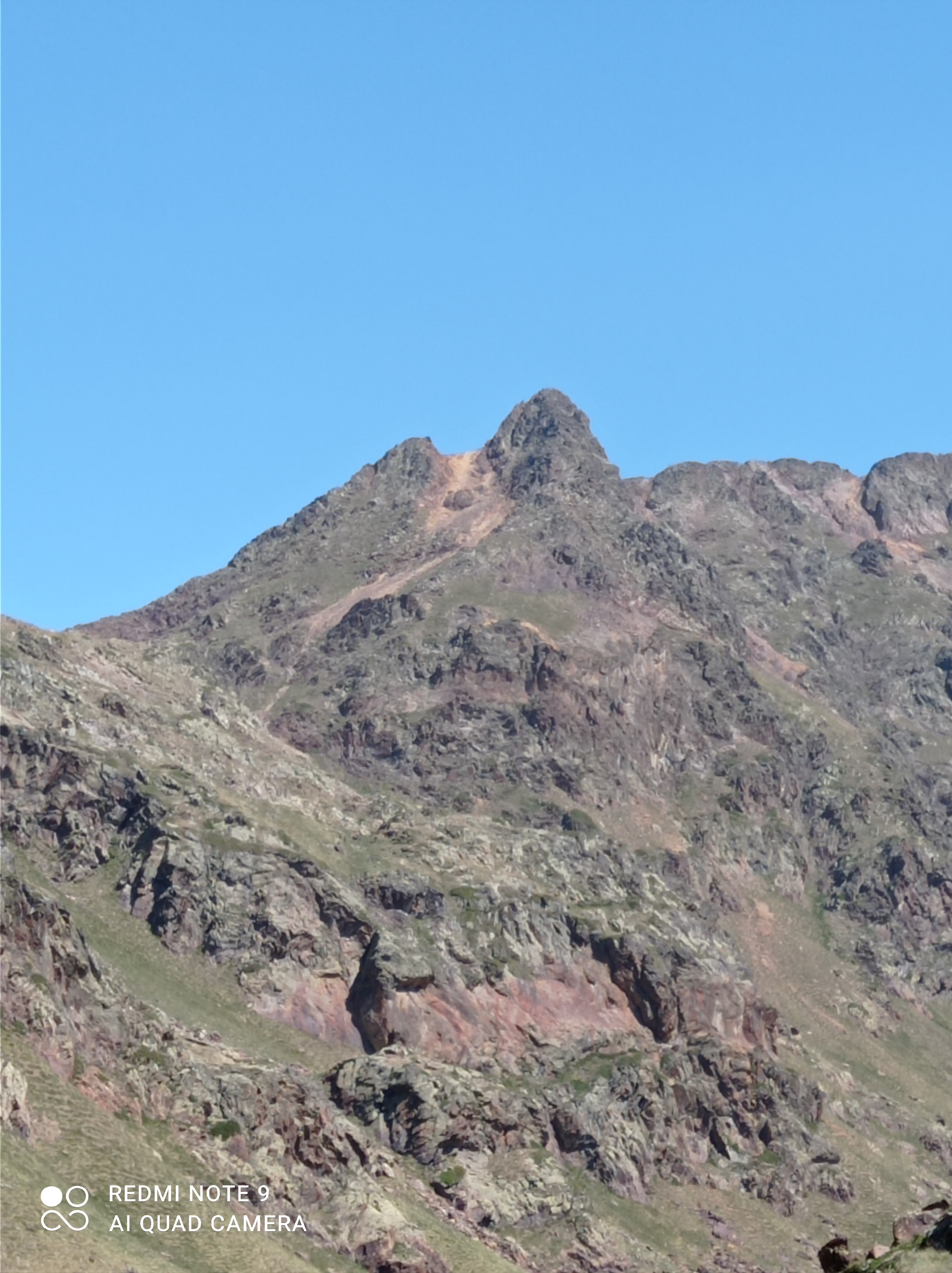 |
| The col I met the ridge first is on the left. Pic de Canalbona is the highest point in this pic. |
 |
| At the lake after sketchy downclimb from the wrong ridge. |
 |
| A nice waterfall on way to the wrong ridge |
 |
| Monteixo to Comapedrosa ridge |